16.2 km | 17.5 km-effort
ytt
bruno doublet
User
Length
398 km
Max alt
196 m
Uphill gradient
3104 m
Km-Effort
439 km
Min alt
-7 m
Downhill gradient
3014 m
Boucle
No
Creation date :
2023-05-27 11:19:18.746
Updated on :
2023-07-15 15:07:15.03
69h17
Difficulty : Very difficult
FREE GPS app for hiking
About
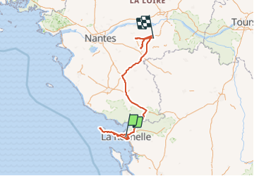
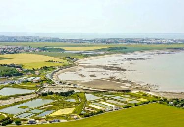
Trail Mountain bike of 398 km to be discovered at New Aquitaine, Charente-Maritime, La Rochelle. This trail is proposed by bruno doublet.
Description
t
Positioning
Country:
France
Region :
New Aquitaine
Department/Province :
Charente-Maritime
Municipality :
La Rochelle
Location:
Unknown
Start:(Dec)
Start:(UTM)
642485 ; 5112775 (30T) N.
Comments
Trails nearby
La Rochelle Châtelaillon-Plage
sport
Very easy
La Rochelle,
New Aquitaine,
Charente-Maritime,
France
43 km | 45 km-effort
Unknown
No
De La Rochelle à Marrans
Hybrid bike
Easy
La Rochelle,
New Aquitaine,
Charente-Maritime,
France
64 km | 69 km-effort
4h 23min
Yes
9 mai 2018 jour 5
Walking
Easy
Aytré,
New Aquitaine,
Charente-Maritime,
France
27 km | 28 km-effort
6h 55min
No
jour 5
Walking
Easy
Aytré,
New Aquitaine,
Charente-Maritime,
France
27 km | 28 km-effort
6h 55min
No
Les marais de Tasdon
Walking
Very easy
La Rochelle,
New Aquitaine,
Charente-Maritime,
France
7.9 km | 8.5 km-effort
2h 9min
Yes
Plage Aytré
Walking
Medium
Aytré,
New Aquitaine,
Charente-Maritime,
France
5.6 km | 6 km-effort
1h 24min
No
Aytre-Chay
Walking
Easy
Aytré,
New Aquitaine,
Charente-Maritime,
France
7.6 km | 8 km-effort
1h 47min
Yes
aytré-angoulins
Walking
Very easy
Aytré,
New Aquitaine,
Charente-Maritime,
France
29 km | 30 km-effort
1h 45min
No